Maggiociondolo Ring Route
Barberino Tavarnelle Municipality
OUTDOOR / TRAILS / CHIANTI
An interesting itinerary with sweeping views through the woods and cultivated fields of the Badia a Passignano protected area.
The path crosses the Badia a Passignano Protected Natural Area (ex ANPIL). The start of the trail is on the side of the entrance to the Badia, where you can park your car and there is also a bus stop.
We take the paved road “via Poggio al Vento”, which descends to become a gravel road and reaches the bottom of the small valley. Along the road we can admire the beauty of the ancient Benedictine abbey founded by St. John Gualbert around the year 1000. After crossing the stream, we find the small Maggiociondolo rest area on the right with an explanatory board.
We turn to the right and walk along the path into the forest. The section in the forest is an old road that is no longer used and whose surface has deteriorated due to the flow of water. The passage is nevertheless smooth. As we ascend, we find another farm road, which we leave to the right hand side. From here the road surface is in better condition.
We reach a house and turn on the left. In front of us we’ll find vastly extended vineyards. The road climbs further and offers ud great views towards the Val di Pesa with Tavarnelle, Barberino and San Casciano.
We’ll follow the road, which after leaving another farm road on the left hand-side, reaches the village of Case Poggio al Vento. Just before the houses, we find on the right a track of a road with dry-stone walls that descends between an olive grove and a small woodland. We descend further until we come to a gravel road where we turn to the left.
We follow the road, which with a few ups and downs reaches a crossroads where we take a left to a lovely path through the woods near the post office boxes and soon reach the rest area of the outward journey. We take the uphill road again and reach the Badia a Passignano from where we started the itinerary.
Points of Interest
Abbey of Badia a Passignano
Route:
Technical details:
- Starting point: Badia a Passignano
- How to get there: coming from Florence and Siena via the Florence-Siena motorway, exit Tavarnelle, signs for Badia a Passignano
- Arrival locality: Badia a Passignano
- Access: Badia a Passignano
- Level of difficulty: E - Hiking
- Any critical points: no
- Experience requirements: Minimum
- Walking time: 3 hours
- Length: 4.7 km
- Total ascent: 139m
- Total descent: 139m
- Maximum height: 442m above sea level
- Minimum height: 285m above sea level
- Signpost: CAI sign no. 458
- Best time to tackle the route: All year round.
- Necessary equipment: Hiking shoes
- Operators offering accessory tourist services along the route:
Bar Il Divino
Osteria di Passignano
Ristoro L'Antica Scuderia

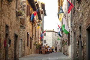
Gallery:


Related Articles
Let yourself be inspired by the legends, stories, and a thousand excellences of this land in the green heart of Tuscany


-1586x1139")