Bridle Path
Municipality of Barberino Tavarnelle
OUTDOOR / TRAILS / CHIANTI
The itinerary begins on the regional road Cassia halfway between Barberino and Tavarnelle at the junction with the Spoiano road.
We take Spoiano street, which after a short while becomes a gravel road. We pass along the road outside the farm and continue downhill to a fork where we turn LEFT.
We descend towards the bottom of the water shed, taking the isolated cypress trees as a reference point. We turn RIGHT along the Borraccia stream and immediately find the characteristic bridleways with some illustrative notice boards. On the upper right we see the distinctive erosion gullies on which we can see the various layers of soil, from clays to alluvial soils.
The path descends gently with the Borraccia stream on the left and its weirs with pools below. Reach the confluence with the Agliena Grande and cross the stream: AVOID the small bridge and wade at the best point.
We follow the course of the Agliena Piccolo for about 1 km and reach a ford at the confluence with the Agliena Grande. We cross the stream and ascend it, keeping to the right, until, after about 700 metres, we find a dirt road (Via le Masse) that rises rapidly.
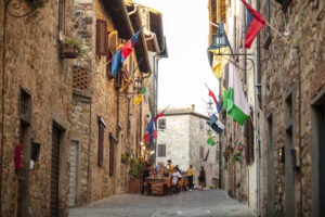
We follow it until we reach the entrance to Barberino, which we cross by Via Semifonte, reaching Via Cassia. We turn left, following the paved road, passing in front of the beautiful church of S. Bartolomeo and following the cycle track parallel to the road we reach the point from which we started.
Points of interest
Agliena Bridles is a unique historical route along the Agliena Grande and Agliena Piccolo streams known for the 27 bridleways described by Leonardo da Vinci in 1500.
Also particular is the history of Semifonte: a former castle town on the hill opposite Barberino that, being an obstacle to Florentine trade along the Via Francigena, was besieged and destroyed in 1202. Today only the dome of St. Michael Archangel and the characteristic fortified village of Petrognano still remain.
Route:
Techical details:
- Starting location: RS Cassia about halfway between Barberino and Tavarnelle, at the junction with Spoiano street
- How to get there: By car
- Arrival point: The same as the start point, it is a circular route.
- Access: Panzano
- Difficulty level: E - Hiking
- Any critical points:
FORD: as indicated in the description, AVOID crossing the small bridge and wade further on at the best point.
RAIN: during very heavy rain the route can become difficult if not impassable due to the impossibility of crossing the fords, with a very slippery and muddy bottom. ANIMALS: near the farm there are animals reared in the wild, with electrified fences. ALWAYS close the gates and do not disturb the livestock. - Experience requirements: Minimum
- Walking time: 4 hours
- Length: 8.5 km
- Total ascent: 373m
- Total Descent: 173m
- Maximum height: 500m above sea level
- Minimum height: 240m above sea level
- Signs: CAI signs
- Best time to tackle the route: All year round. Avoid periods of heavy rain.
- Necessary equipment: Hiking shoes
- Operators offering accessory tourist services along the route:
ACCOMODATIONS FACILITIES:
Agriturismo LE TRE API
Agriturismo LA SPINOSA
Agriturismo e Affittacamere FATTORIA VILLA SPOIANO
RISTORO:
Agriturismo e Affittacamere FATTORIA VILLA SPOIANO
Fattoria LE MASSE
various restaurants in the historic centre of Barberino Val d'Elsa.

Gallery:


Related Articles
Let yourself be inspired by the legends, stories, and a thousand excellences of this land in the green heart of Tuscany


-1586x1139")