The Battle of Monteaperti
Municipality Castelnuovo Berardenga
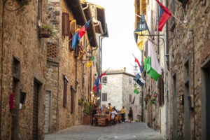
OUTDOOR / PATHS / CHIANTI
"Lo strazio e 'l grande scempio. che fece l'Arbia colorata in rosso, tal orazion fa far nel nostro tempio". With these words, Dante Alighieri responds to Farinata degli Uberti, indicating the reason for so much hatred towards him on the part of the city of Florence.
He is referring to the Battle of Monteaperti, which on 4 September 1260 saw the Ghibelline Siena troops heavily defeat the Guelph Florentine troops.
With this short route of about 10 km, consisting of paths 335, 334 and 370, you can retrace the battle sites, running along the Malena torrent, which was first soaked in the blood of the defeated, until it flows into the nearby Arbia torrent, of which it is a left-hand tributary.
The place symbolic of the battle is also the distinguishing point of the route, the Cippo di Monteaperti, a stone pyramid that stands on a hill surrounded by cypress trees and is intended to commemorate an event that for Siena is a source of pride and pride that has never been forgotten.
Through the short section of path 370 between the intersections with paths 334 and 335, it is possible to shorten the route and divide it into two smaller loops, one centred on the battle plans and the source of the Acqua Borra, the other on the Cippo (memorial stone) built in memory of the battle itself.
Points of interest
The route develops around the Cippo (memorial stone) commemorating the battle between Siena and Florence on 4 September 1260, but allows you to skirt for long stretches along the Malena torrent, made famous by Dante even though he cited it as Arbia, in an area of high scenic value, also characterised by the hot mineralised water spring of Acqua Borra, known as the thermal baths of Siena
Route:
Technical details:
- Departure locality: Acqua Borra locality, Montapertaccio and Monteaperti locality
- How to get there: By car
- Arrival locality: circular route
- Access: The locality of Acqua Borra is located near the Casetta/Monteaperti exit of the SGC Siena-Bettolle, while Montapertaccio and the hamlet of Monteaperti are located along the Sp111 road, which from the aforementioned exit continues in the direction of Chianti. From the hamlet of Monteaperti, the route passes just a few hundred metres away.
- Difficulty level: E - Hiking
- Any critical points: White roads, woodland paths and vineyard roads, no particular difficulties.
- Experience requirements: Medium
- Time required: 3 hours
- Length: 10 km
- Total ascent: 275m
- Total descent: 275m
- Maximum height: 255m above sea level
- Signs: CAI signs (red and white stripes) and descriptive panels
- Best time to tackle the route: All year round
- Necessary equipment: walking shoes
- Operators offering accessory tourist services along the route:
- The Montaperti Pass
- Montaperti
- The Pietrevive
- Villa Brignole

Gallery:
")
")
")
")
Related articles
Let yourself be inspired by the legends, stories, and a thousand excellences of this land in the green heart of Tuscany.


-1586x1139")