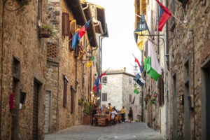
344 - Castellina - Radda
Municipality Castellina in Chianti and Radda in Chianti
OUTDOOR / TRAILS / CHIANTI
Ancient road leading from Castellina to Radda. It winds through mainly wooded areas with beautiful views.
Route:
Technical details:
- Starting point: Castellina
- How to get there: car, bus
- Arrival point: historic centre of Castellina
- Access: piazza
- Difficulty level: T - Tourist , E - Hiking
- Any critical points: length
- Experience requirements: Basic
- Walking time: 3.45 hours
- Length: 10.3 km
- Total ascent: 373m
- Total Descent: 445m
- Maximum height: 622m above sea level
- Minimum height: 431m above sea level
- Signs: signs on natural features
- Best time to tackle the route: all year round
- Equipment required: basic trekking
- Operators offering ancillary tourist services to the route:

Gallery:


Related articles
Let yourself be inspired by the legends, stories, and a thousand excellences of this land in the green heart of Tuscany.


-1586x1139")