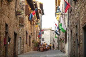
San Polo ring route
Municipality of Barberino Tavarnelle
OUTDOOR / PATHS / CHIANTI
An interesting route in the northern area of the characteristic medieval village of San Donato in Poggio.
The itinerary turns through woods and vineyards towards the Pesa river, beginning in the eastern part of the village.
From the crossroads on the provincial road, we take the asphalted Montecchio road, which shortly after becomes a white road.
We follow the road through vast vineyards to the crossroads with cypress trees and a tabernacle where we turn left, still following the Montecchio road.
We skirt the buildings of the Montecchio kiln and follow the unpaved road down into the woods. The path skirts an olive grove on the right.
We cross a clearing with a ruin and continue downhill into the grove, reaching another clearing with another ruin.
Points of interest
This route is partly a stretch of the Via Romea Sanese of Chianti, which connects Florence to Siena.
Route:
Technical details:
- Starting location: San Donato in Poggio
- How to get there: By car or bus
- Arrival locality: San Donato in Poggio
- Access: San Donato in Poggio
- Level of difficulty: T - Tourist, E - Hiking
- Any critical points: no
- Experience requirements: Medium
- Time required: 2.5 hours
- Length: 5.3 km
- Total ascent: 134m
- Total descent: 145m
- Maximum height: 413m above sea level
- Minimum height: 227m above sea level
- Signs: CAI signs (red and white stripes)
- Best time to tackle the route: All year round
- Equipment required: Hiking shoes
- Operators offering accessory tourist services along the route: Refreshment points in the village of San Donato. Possibility of booking wine and oil tastings at Montecchio Farm.

Gallery:


Related articles
Let yourself be inspired by the legends, stories, and a thousand excellences of this land in the green heart of Tuscany


-1586x1139")